Portal, AZ - Rodeo, NM
Serving The Communities Of Portal and Rodeo (www.portal-rodeo.com)
Serving The Communities Of Portal and Rodeo (www.portal-rodeo.com)

Click On Any Image To See It In Its Original (Larger) Size
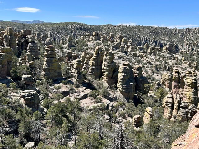
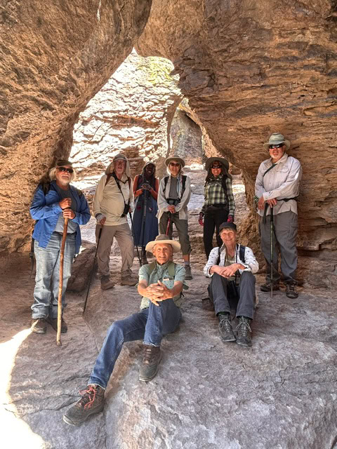
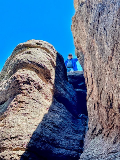
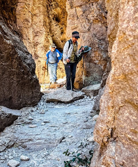
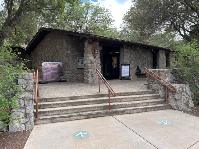
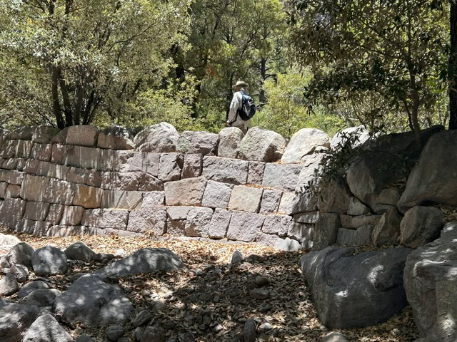
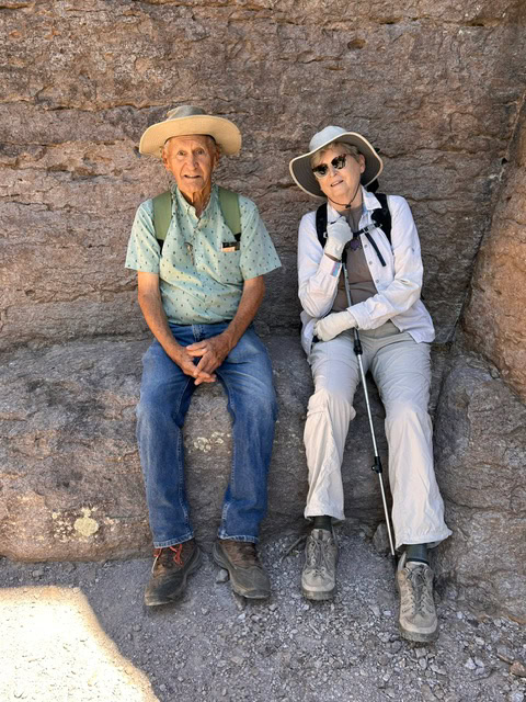
Nine hikers drove to the spectacular Chiricahua National Monument for a hike (mostly) down the 4.5 mile Echo Canyon Trail, starting at the Echo Canyon parking lot and ending at the Visitor Center. Below you see the group at the Echo Canyon Grotto.
Visiting the Monument is always one of our favorite activities, with world-class hiking. I often find myself humming the Beatle’s Magical Mystery Tour as I walk through this special place.
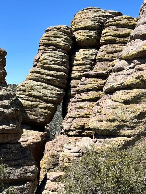
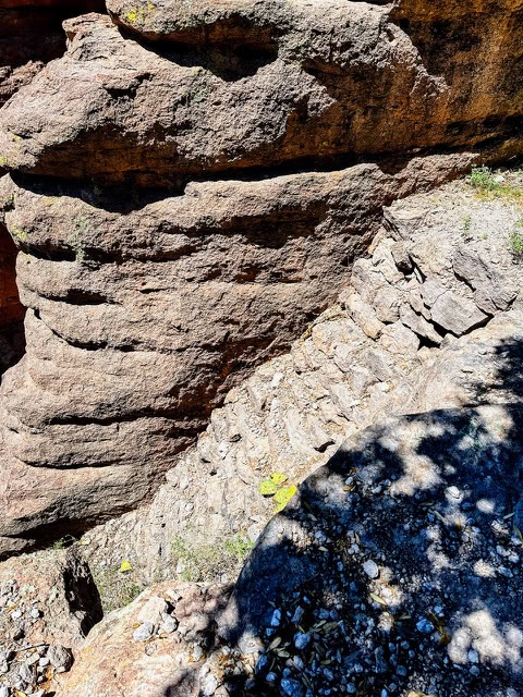
The monument was established on April 18, 1924, to protect its extensive hoodoos and balancing rocks. Between 1934 and 1940, the Civilian Conservation Core built the infrastructure that defines the park today. This includes 17 miles of hiking trails, the rustic stone visitor center and the eight mile drive to Massai Point.
The trail system was built under Foreman Ed Riggs, and one of the trails bears his name today. One of the things that impressed us was the extensive stone work along the trail, defining the trail, supporting the trail, preventing erosion, etc.
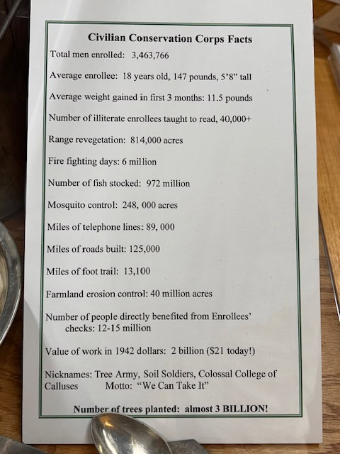
The summary below, of the nationwide contributions of the CCC from 1933 to 1942 is quite impressive. Franklin D. Roosevelt’s New Deal established this program on March 31, 1933. It provided jobs for over 3 million unemployed, unmarried men between 18 and 25 (later 17 - 28) during the Great Depression. The program ended as WW II began.
It was a fine day for hiking, with blue skies, acceptable temperatures and sometimes a slight breeze. We all look forward to our next trip to the Chiricahua National Monument. There are many other trails to explore.
Next week we will stay closer to home, hiking in South Fork. It will be an out-and-back hike so you can go as far as you wish. Note that there have been reports of significant amounts of poison ivy along the trail so wear long pants. Bring the usual — water, lunch, hat, sunscreen, etc. Meet at the Silver Peak Trailhead at 8 a.m. AZ, 9 a.m. NM.
Happy trails!
Report by Carol
Photos by Carol and Eskild
Hiking
May 14 - Chiricahua National Monument
Meet at the Silver Peak Trailhead at 8:00 a.m. AZ, 9:00 a.m. NM
Carol Simon (520) 558-2433 casimon1947@icloud.com
Elaine Moisan (520) 558-5204 emoisan2011@hotmail.com
Elly Van Gelderen (520) 558-3715 or ellyvangelderen@asu.edu
__________________________________________________________________________
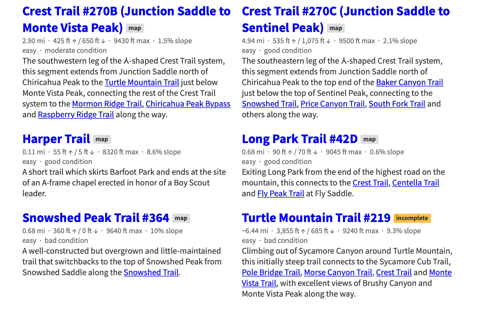
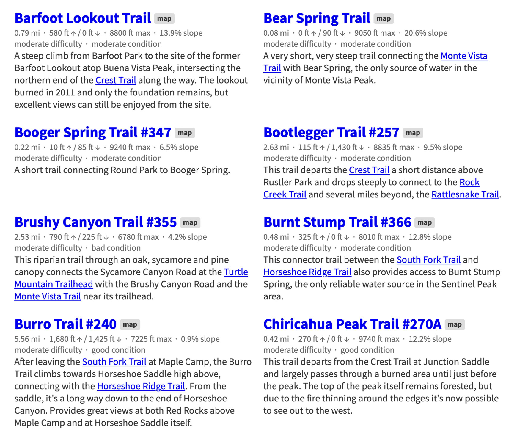
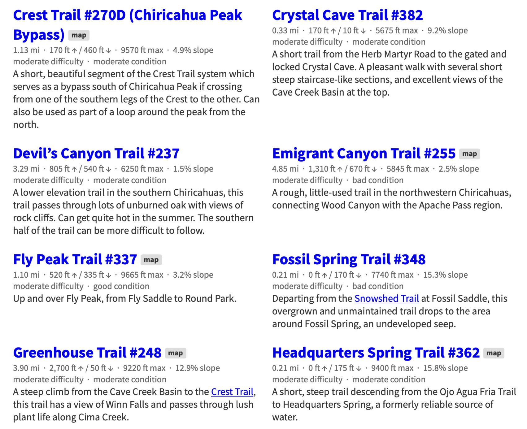
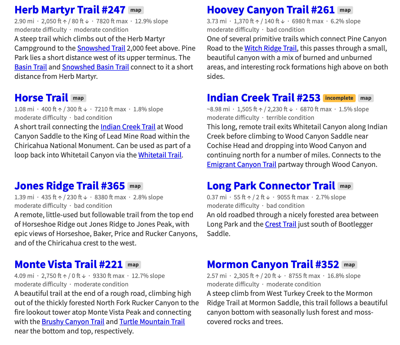
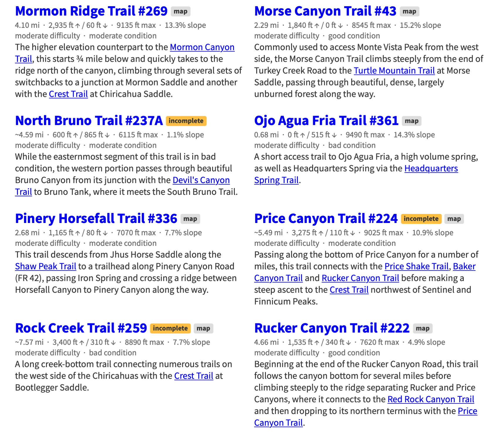
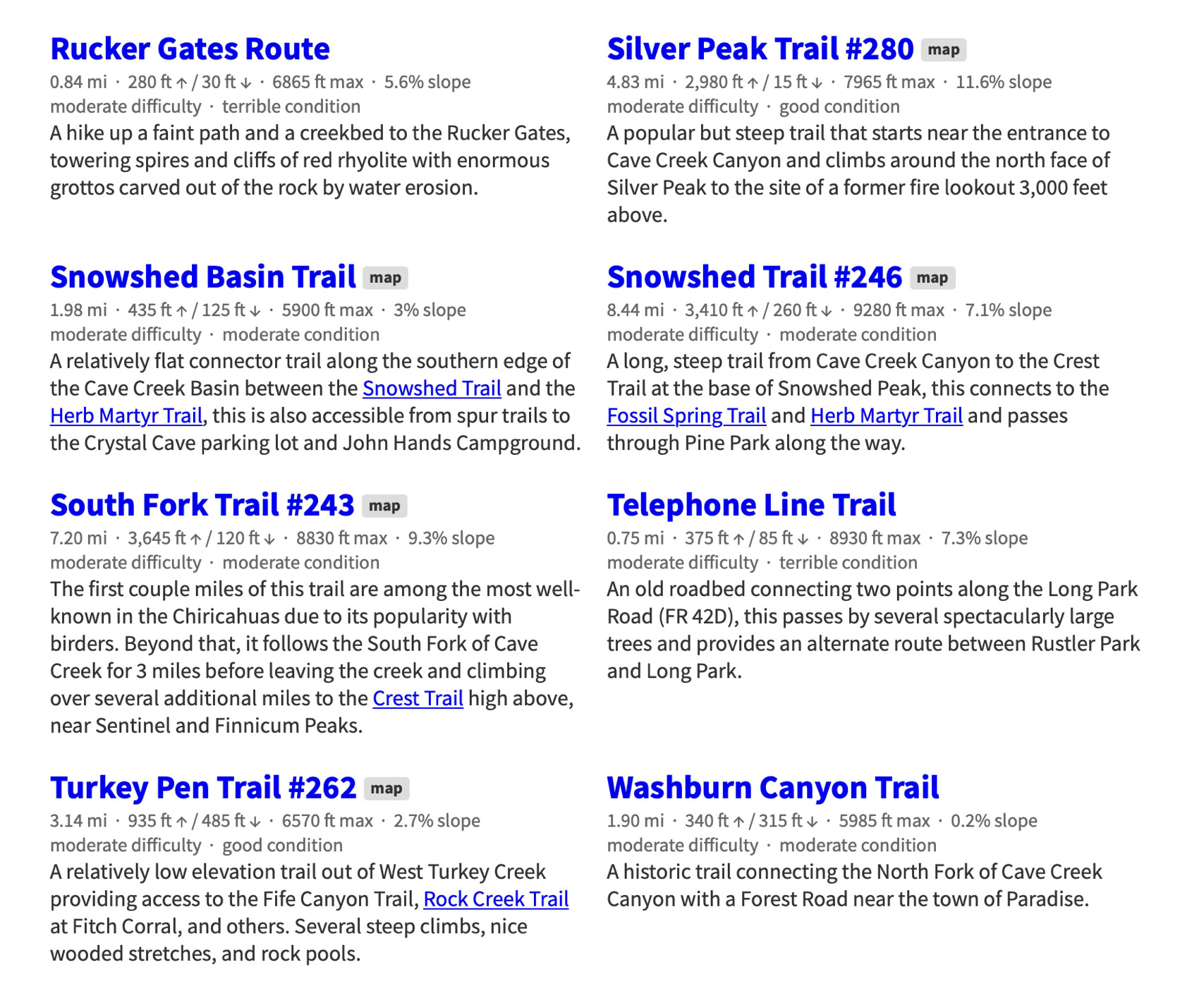
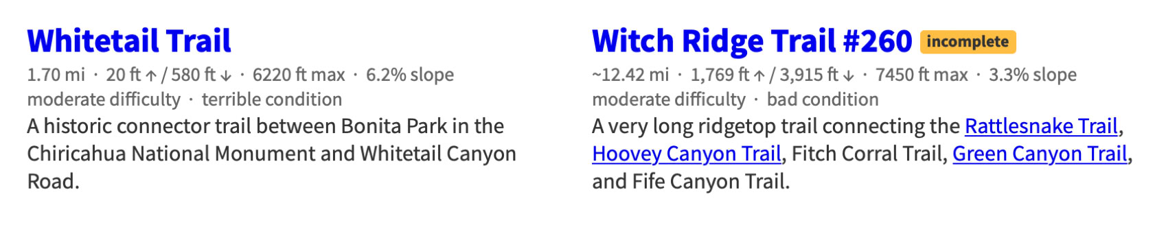
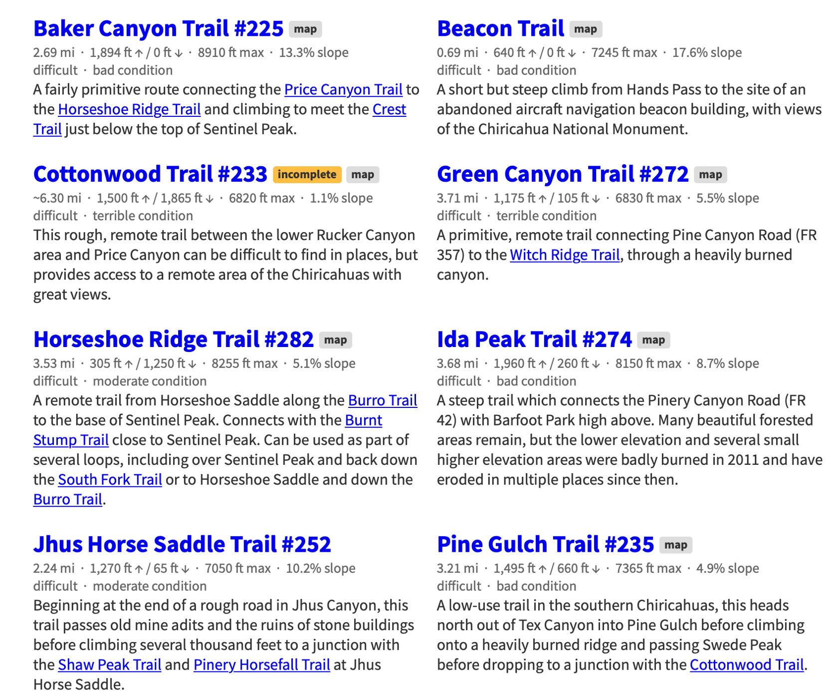
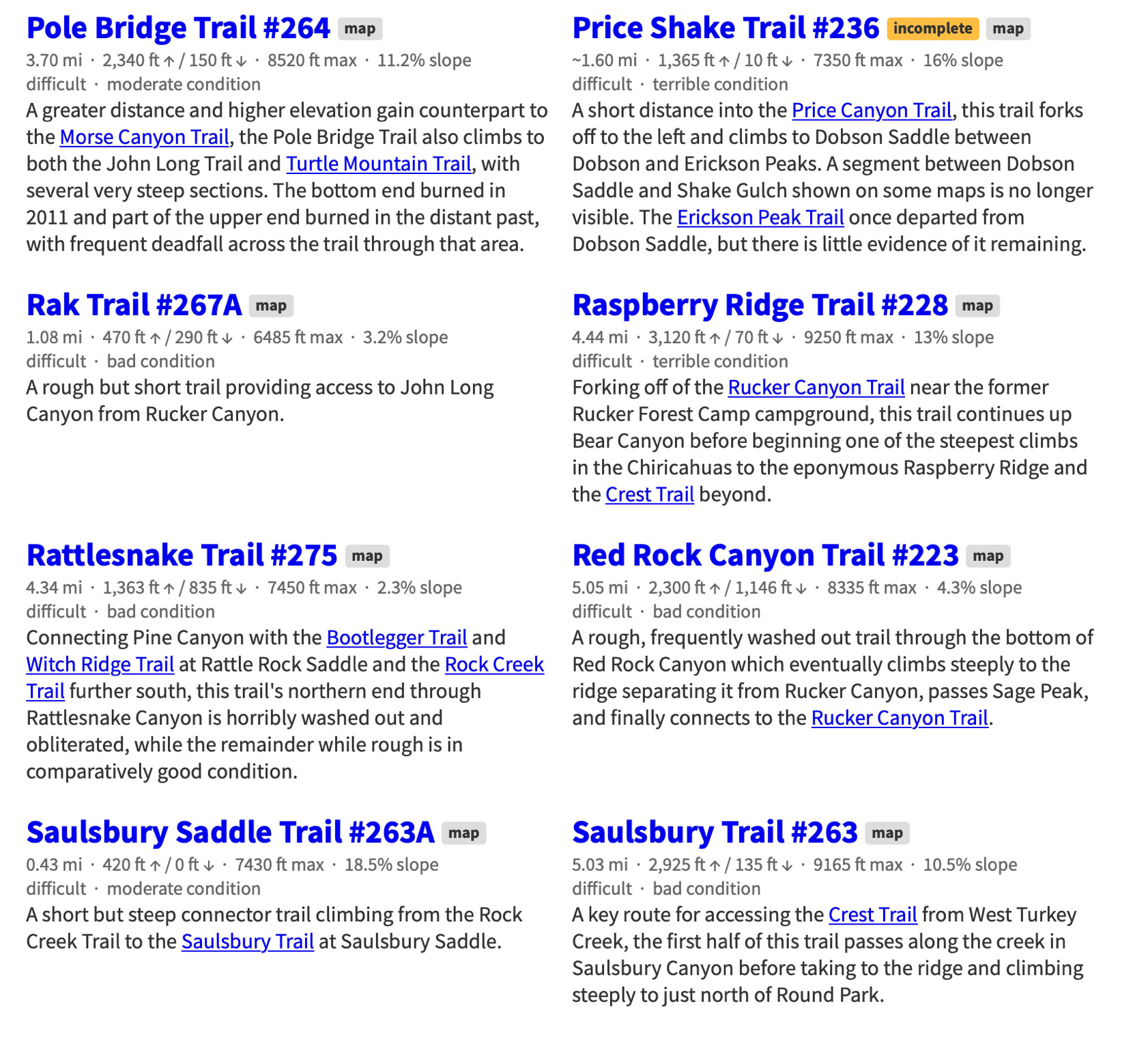
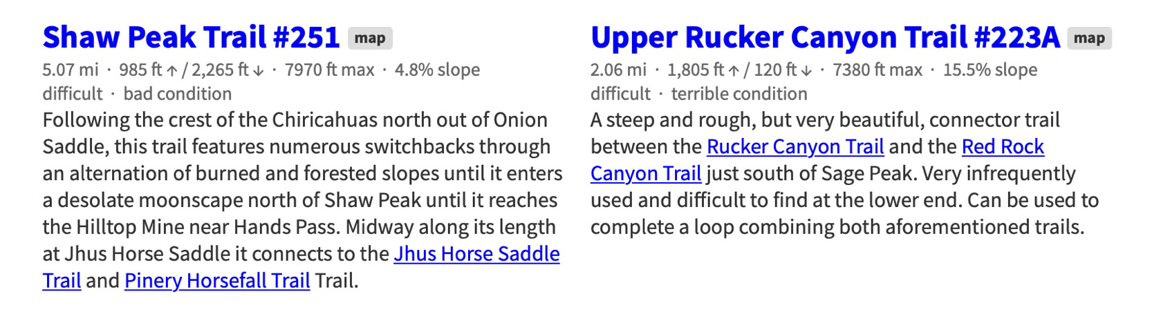
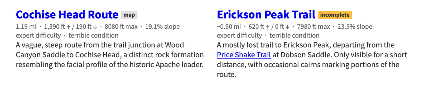
Chiricahua Mountain Hiking Trails
This project -a Herculean task - was started by Jonathan Patt as a collection of GPS data recorded while hiking in the Chiricahua Mountains of Southeastern Arizona starting in 2012 and expanded slowly into this site over a six month period beginning around 2013, during which it became obvious that much of the existing Chiricahua hiking information is out of date and, for some trails, nonexistent. This site is an attempt to resolve that problem.
If you would like to see a map of these trails or want more information about the project visit the Chiricahua Mountains Hiking Trails web site at:
Easy Trails
Moderate Trails
Difficult Trails
Expert Trails
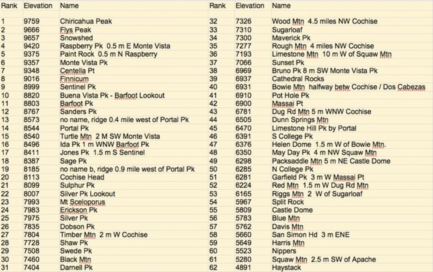
The 62 Highest Peaks, Mountains, Hills, And Lookouts In The Chiricahuas
(Tabulated by Ray Brooks)
(Form Necessary To Work With Trail Crew)
Download - Complete - Mail
To volunteer with the US Forest Service, fill out an application. If accepted, a Volunteer Service Agreement specifying the task(s) will be sent to you.
DOWNLOAD THE FORM. Print it, fill out, sign in block 23, and date. You can scan a signed document and e-mail it toArmando Arvizu at: armando.arvizu@usda.gov
You can also mail the form to Armando at the Douglas Ranger District Office:
1192 W. Saddle View Rd. Douglas, AZ 85607
People can join the list automatically by sending an email to portal-rodeo-hiking+subscribe@googlegroups.com and they should start receiving messages.